3D city models
Explore new opportunities with 3D modelling in real time at citizen meetings and workshops, where you get both 3D visualisation of scenarios and on-the-fly calculation of key figures.
How can the building be placed? How much can be built? Number of floors? Shadows? What will be the parking requirement?
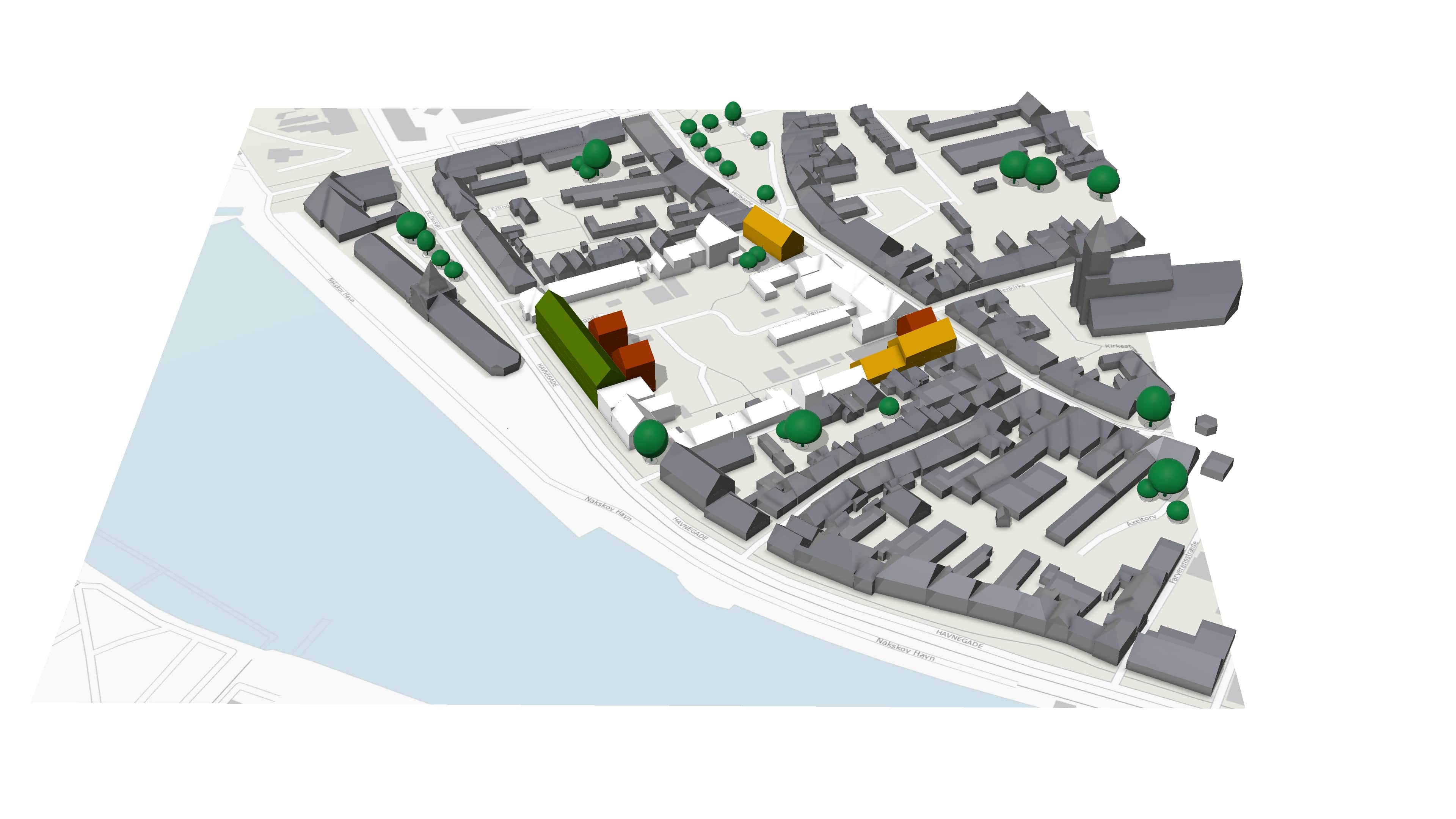
Real-time conflict search in 3D
NIRAS has introduced new digital tools in the planning processes, which can be used to compare and assess different building and construction proposals. In an integrated process, information from e.g. BBR, thematic map layers and road construction lines or other restrictions is combined with intuitive 3D modelling tools, which on-the-fly shows whether there are conflicts with the building regulations and also calculates key figures for the various scenarios.
Key figures
On-the-fly calculations of key figures for the various scenarios – e.g. total floor area, parking area in relation to standard figures or compliance with requirements for the extent of green areas. If the key figures are supplemented with costings, the first rough estimates of some of the economic consequences of the various scenarios can be shown. The key figures can also be exported to Excel or other tools, where they can, for example, be included in BI analyses and decision support.
Citizen involvement
Citizen involvement is part of what NIRAS is working with in digitising the planning processes together with the municipalities, where our solid knowledge of 3D city models is included in all phases of the planning.
Concrete experiences from citizens' meetings, where we have used parametric modelling, show that 3D city models are particularly effective for communication and dialogue with citizens about the development of our cities. For example, parametric modelling was used at a workshop in Næstved on the conversion of an old factory site into a new recreational and sustainable residential area in Glumsø.
3D city models online with OpenCities Planner
Do you want to boost the involvement of citizens and other stakeholders in the debate on urban development and the planning of the open land? Do you need to be able to assess projects of builders, developers or others in a digital model of reality?
Then the virtual 3D platform OpenCities Planner can be the effective solution you need.
Plans and projects are visualised in a 3D model of the existing surroundings and users can freely navigate in an Internet browser to any position in the model. In this way, the individual can see how a future building, a new road, new masts etc. will look from any selected position.
SketchUp plugin for city planning
NIRAS has launched a plugin for SketchUp: Modelur DK, is targeted at planners and others who work with local plans and development plans. The tool is linked to plandata.dk and it is therefore possible to see both local plans, sub-areas and construction fields directly in SketchUp for the area the planner is working on. This applies to both adopted local plans and the draft.
With Modelur DK, it is possible to sketch and check in 3D, for example, the building percentage, number of floors, building heights, total floor area and the need for parking spaces. It is all parameter controlled and intuitive to work with.
Property development
Parametric modelling is not only relevant in the planning processes for municipalities, but to a large extent also for property development in the private sector. With the digital 3D tools and the link to plans and building information from respectively plandata.dk and BBR, it is possible for property owners, their advisors or others who want to assess the possibilities within an area, to quickly and intuitively test different scenarios against subsequent business processes.
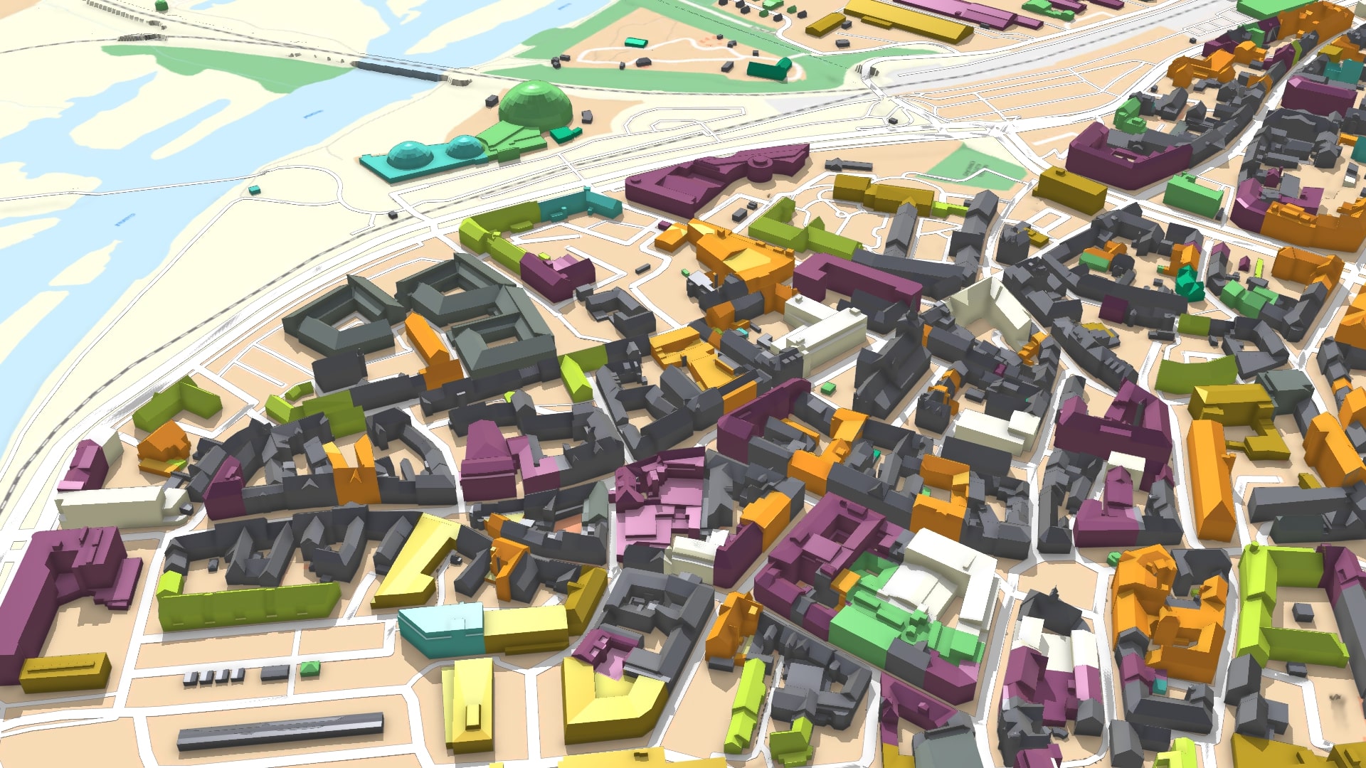
3D city models’ level of detail
Overall, we produce 3D city models in two different ways: Photogrammetric, where the model is based on a specification ('product declaration') and semi-automatic, where geometric accuracy cannot be guaranteed. The two model types both have a connection with the authoritative data and they can also be combined, so that there are areas with a high degree of detail, and areas with less accuracy in the roof profiles. Many of the municipalities we work for have precisely this combination of the two model types.
Combined models provide a relatively economic means to getting municipality-wide 3D models. Second, 'semi-automatic' areas can be replaced with detailed 3D data if needed. One such area could be, for example, an area in a smaller urban community that needs to be transformed or developed and where a local plan must therefore be drawn up.
It should be noted here that the 'semi-automatically' produced 3D city models are produced on the basis of point cloud data from the national elevation model, which is updated in a five-year cycle.
It is absolutely crucial to ask yourself: What will the 3D model be used for?
Will the city model be used for visualisation, to boost citizen involvement, to streamline work with plans and projects? Will the city model be used together with the so-called 'authoritative data' (basic data with well-defined, well-documented and clear quality objectives), or something entirely different?
Get in touch
