News
New and disruptive technology improves understanding of an important carbon stock ‒ tropical dry forests

News
NIRAS-LTS has delivered four innovative and affordable solutions that make use of freely available satellite data to help forest managers assess and prevent deforestation
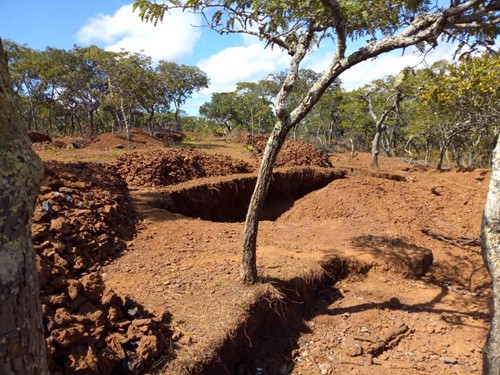
Even though they represent 27% of the world’s forest cover and some 2.7 million square kilometers in Africa alone, tropical dry forests are subject to some of the highest rates of deforestation and degradation around the globe. These ecosystems, which represent an important carbon storage, are particularly at risk due their fragility and the high demand for forest goods and services required to support the livelihoods of large numbers of the world’s poorest people.
To properly conserve and manage dry forests, countries need reliable information on their extent and condition and to understand what drivers are causing change. Despite their importance, little is known about dry forests and they are often not covered by inventories and management planning. Recent major breakthroughs in satellite earth observation (EO) data provision provide unprecedented views of the globe and present an opportunity to address existing limitations in forest monitoring capabilities. Many satellite missions (e.g. NASA’s Landsat and the European Space Agency’s (ESA) Sentinel-1 and-2) offer free and open access to their data.
tropical dry forest’s share of the global forest cover
of the sub-Saharan population depend on dry forests for livelihoods
Benefits of EO data:
To develop satellite EO methods and global knowledge for monitoring dry tropical forest ecosystems and assessing forest degradation, the World Bank with technical support from the ESA developed the Satellite Monitoring for Forest Management (SMFM) project. Implemented by LTS-NIRAS, SMFM was launched in 2017, and delivered tools over a three-year period that today allow forest practitioners to use new satellite resources for forest cover and biomass assessment, dense time-series change analysis and analysing the drivers of forest change.
Practical tools and support on the ground
SMFM developed four remote sensing tools, which were piloted in Mozambique, Zambia and Namibia. These tools were based on open source data, making them free to use, customize and develop further:
In addition to these useful tools specifically tailored to the needs of forest managers, SMFM worked with the three governments to develop national technical capacity for monitoring tropical dry forest landscapes and forest degradation assessment. Local forest officers were introduced to the tools and continue to use them today in their work.
![]()
The SMFM tools and supporting documentation are hosted on FAO’s System for Earth Observation Data Access, Processing and Analysis for Land Monitoring (SEPAL) site that provides an access to number of other EO tools as well. The tools can also be run also on ESA’s Forestry Thematic Exploitation Platform (F-TEP) as well as on individual computers. The tools are also available for download on Github.
Watch the full Global Landscape Forum plenary on video where SMFM is presented.
I am really pleased to see that forest management and monitoring in tropical countries is going digital. We had the pleasure of working with young smart forestry officers who full grasped the opportunities offered by the SMFM tools. They were able to tap into the online satellite data resources and leverage cloud processing performance to produce really encouraging results.
Martin Schweter, Team Leader for SMFM
Earth observation and geographic info services