Project

Mobile technology-powered projects make significant strides in raising awareness on climate change among Indonesian communities

GSMA MEL 20230618 111153

Despite the short window between the implementation of the projects and the evaluation, the team still observed significant changes and improvements in knowledge among village residents, a core feat for the three projects.

Assessing three Mobile Innovation Hub projects in green energy, waste and natural resource management, a NIRAS monitoring, evaluation and learning assignment found they gave residents the means to access data on climate change and the environment they live in, empowering them to make informed decisions in their day-to-day lives.

April 4, 2024
  • SDG: #4, #9, #10
  • SECTORS: Development Consulting
  • COUNTRIES: Indonesia
  • DONOR: GIZ
  • CLIENT: GSMA Mobile for Development Foundation
  • CONTRACT VALUE: EUR 80,095
  • DURATION: December 2022 - July 2023

The nature of climate change is marked by strain — dramatic shifts in weather patterns, the relationship between human activity and the planet’s rhythms, sudden rises in temperature. This global issue is so rooted in the natural world, with talk of fossil fuels and greenhouse gases, that it is hardly surprising many of us overlook the potential of mitigating it through the power of technology, much less the tech in our pockets and purses, namely, our mobile devices.

As part of the monitoring, evaluation and learning (MEL) services we delivered to GSMA, a global organisation bringing together over 1000 mobile operators and businesses across the ecosystem and related industries to advance innovation and reduce inequality, NIRAS provided insights into the power of mobile technology to address climate and waste issues.

We assessed three projects in the green energy, waste and natural resource management sectors which were funded through the Mobile Innovation Hub (MIH). MIH is a joint GSMA and GIZ initiative that assesses opportunities for creating socio-economic impact through mobile digital innovations, fosters partnerships among the local digital and mobile ecosystem players to provide capacity building on the role of digital for good, and advocates for enabling environments.

Climate change will cause floods that have never happened before. I can use Windy to check what things I can do in severe weather. It also gives me contact numbers in case of an emergency and I can see wind speeds. 

Rahmat Wijaya, a fisherman

Understanding the accessibility of climate change knowledge through digital means 

Dubbed the ‘Self-Sufficient Tower’, this MIH-supported project aimed to bridge the digital divide and enhance climate resilience in Natuna District, Kepulauan Riau, Indonesia. Through a series of workshops, including a session on climate and mobile technology literacy for local champions, the project sought to improve internet access and usage, ultimately boosting productivity and climate resilience in the region.

NIRAS determined that the Self-Sufficient Tower positively impacted the Natuna District community. Our team of MEL experts shared several key findings, namely: 

  • Significant improvements in knowledge, attitudes and behaviours among local champions; 
  • Promising progress in knowledge, attitudes and behaviours among community members; 
  • An empowering shift in knowledge, attitudes and behaviours among female digital literacy participants; and 
  • Positive changes at the institutional level. 

Rahmat Wijaya, a fisherman, needs to be resourceful when navigating the sea. He attended a GSMA-organised workshop detailing the features and benefits of a mobile application called Windy, which supplies fishermen with information on the weather for the day.  

"We did not know about global warming and its impacts. Now we do," the 37-year-old Rahmat said, adding that he would let his fellow fishermen in on the insights and knowledge he gained through the workshop, helping spread the word to others in his community. Additionally, while Rahmat has been using Windy for years, the workshop motivated him to share information on the application with others.

GSMA MEL 20230618 111156

Sustainable waste data management 

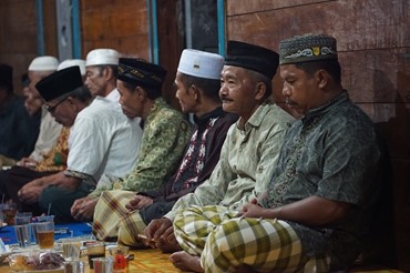
The second project, ‘Waste Data Digitisation’, focussed on supporting the government and the waste ecosystem players to make more well-informed decisions and streamline and build more effective waste data management processes. This initiative involved conducting workshops to inform policymaking and ideation, with the ultimate goal of enhancing waste management practices and promoting sustainability in Bali’s Denpasar city where tourism has resulted in various waste management challenges. 

Our MEL team also found this project to be successful – in this case on raising awareness about climate change and waste data management. This is the case for government and non-government organisations, including partners from the government office Denpasar City Environment and Sanitation Service. Government partners also hold the research done through Waste Data Digitisation in high regard, deeming it critical in helping them make informed decisions and enhancing waste data monitoring quality. The team also found that the Denpasar City Environment and Sanitation Service considers the project insightful and possibly influential in enhancing its existing waste information system. 

I Gusti Ngurah Gede Budhita is a division head at the Denpasar City Environment and Sanitation Service in charge of waste reduction. He also heads the development and management of the application SIDARLING, designed to support waste reduction, waste bank operations and community education on waste segregation. The 49-year-old government worker actively participated in GSMA-organised activities, which included a baseline survey, an ideation workshop, a policymaker workshop and more. These activities, he shared, have been invaluable and bore insightful and actionable directions for his office. 

"Generally, we are aware of the conditions and needs in the field, but they have not been formally documented, based on thorough surveys and well-documented results, and presented to policymakers," I Gusti Ngurah Gede Budhita says. "The findings presented confirm our assumptions with accurate data." 

Adi Wiguna, who heads the Waste Handling Division of the Denpasar City Environmental and Hygiene Office, was changed after the project. After his participation in the same Waste Data Digitisation’s activities, he found himself warming up to the idea of a partnership between the government office and the mobile technology organisation. 

"Although I had initial doubts, the ongoing process has made me support it because it can be implemented, of course, with the support of facilities and infrastructure so that it can be carried out effectively in the future in a real way," he says.


GSMA MEL 20230618 104422

The power of participatory mapping 

For the final GSMA project, which used innovative and accessible digital solutions to protect mangroves, NIRAS determined that there have been significant behavioural changes within the community. 

Through participatory mapping, residents were able to monitor the distribution and clearance of mangroves. They can even access the data through their smartphones. This enabled community members to develop a deeper appreciation for collective responsibility towards the environment, even pushing residents to collaborate in the conservation of mangrove forests. 

The team also found that there has been: 

  • Greater awareness of how and where to access the digital map; 
  • A better understanding of how conserving mangroves relates to protecting the environment; 
  • An increased inclination to protect mangrove trees among those who accessed the digital map.

"I just found out that there are 28 artificial rivers in Setabu," says Rambli, who is the head of the village. "I thought there were only 10, it turns out that there have been so many this year." Like Rambli, residents reported learning crucial information about different locations in the area, including man-made and natural rivers, nipa palm areas, spots for seaweed cultivation and of course areas for mangrove conservation, among others. 

GSMA MEL 20230618 104619

This has led to smarter and more informed decisions in the community. The map enabled residents, especially beginners, to plant more efficiently by locating fertile areas. It also showed them there are 28 canals, as Rambli said, which helped them improve resource planning and utilisation. And it even educates the residents on unauthorised activities they may not have been previously aware of. 

"In the past, if we were making the foundation, we just made it. We didn't need a permit. Suddenly someone cut it off for exceeding the transportation limit," village officer Sulika says. "The loss could be tens of millions; who would be responsible for that? Now, we already know which areas are allowed and which are not allowed."

GSMA MEL 20230618 111147

Despite the short window between the implementation of the projects and the evaluation, NIRAS MEL officer Britania Rohanauli Manik says they still managed to see significant changes and improvements in knowledge among village residents, a core feat for the three projects.

"This underscores the power technology — mobile or otherwise — to inform, educate and promote change when made accessible," Britania says. "We observed major changes in the way community members think about climate change as a result of these innovations. Individuals are now more inspired to act collectively and ensure the harrowing effects of climate change are mitigated in the future."

Arum Sari

Arum Sari

Country Director

Jakarta, Indonesia